Weather prediction for farm operations from September to November 2026 show some will be luckier than others
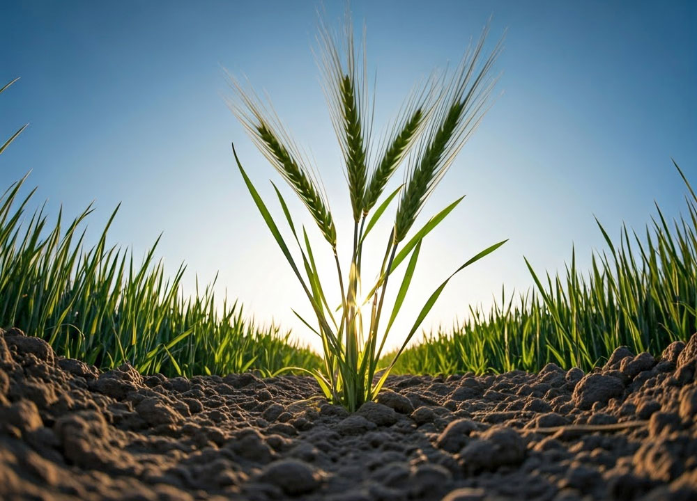
Grain growers in particular have shown a lot of fortitude in this current 2026-27 season.
High diesel and fertiliser costs triggered by the US/Israel attack on Iran at the start of the planting season on 28 February 2026 did impact a solid two-season run with plantings that reached a 25.1 million/ha record last year, taking a tumble to 23.6 million/ha this season.
And that drop in plantings could have been far greater but represents the follow through of strong future plans growers had already adopted to increase their cropping ground, and as a result income.
And why not expand, farmers had just come off a record farmgate income in the 2025-26 season of $101.4 billion with livestock included. A few more dollars for inputs weren’t going to break the bank.
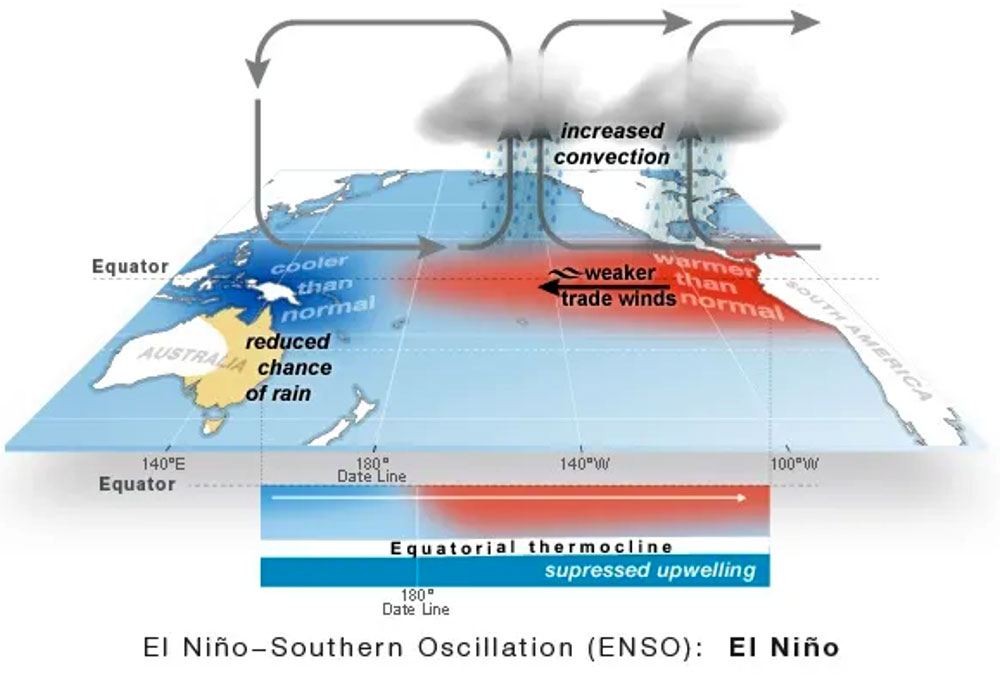
But putting the now long and exhausting middle-east conflict aside, a regular foe has raised its ire. The wrath of El Niño has been now measured as more of a factor in the long-range weather forecast for September to November.
However, while weather modelling indicates El Niño is firmly established and continues to strengthen according to the Bureau of Meteorology (The Bureau).
Many world weather models, including The Bureau’s, forecast the tropical Pacific to continue warming through spring, with the likelihood El Niño with peak in late spring or summer as a very strong event.
Growers will be in a race right up to harvest, and it is a race that many can win and get their crop off prior to the worst of this El Niño bite.
Most obvious takeaways from weather events
Rainfall events will be selective across the country and are likely to be below average across parts of the south and east farming regions, with the welcome exception of the possibility of being above average across much of the western half of Australia.
But bear in mind that it could be dry through September and may take until October for WA growers to reap the benefits of scattered rainfall events.
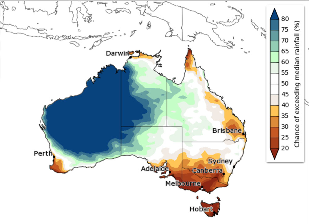
Take a look at the map below as it indicates growers in WA and near the SA border have the greatest chance of securing above median rainfall to end the current cropping season.
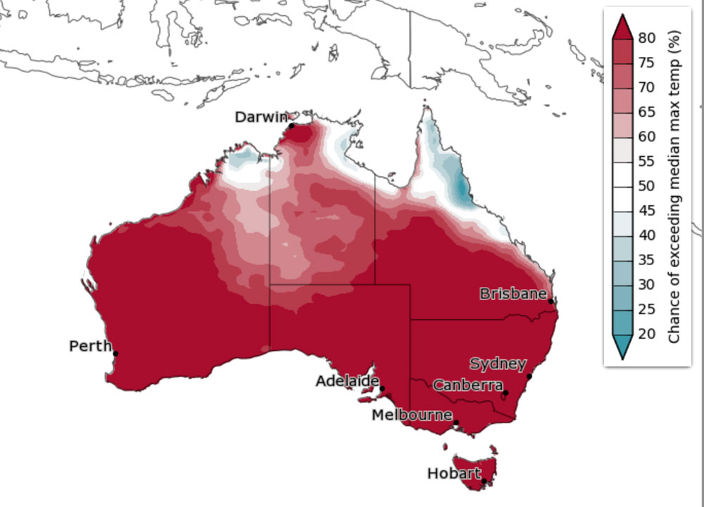
In addition, likely to affect most regions and in particular any farm operation south of the tropics is daytime temperatures that are likely to be above average as the velocity of El Niño picks up.
While overnight temperatures are likely to be above average for most of the country.
As the map below indicates, the chance of above median maximum temperatures across the country at 65 to 80% will be hard to escape leading up to harvest.
How the rain is expected to be shared
Below average September to November rainfall across parts of the south and east, with the possibility of above average falls in the west
Predictions from The Bureau modelling suggest September to November rainfall is likely to be below average (60% to greater than 80% chance) for the far south-west of Western Australia, south-eastern Australia including Tasmania, and parts of eastern and northern Queensland.
With the possibility of an increased chance of unusually low rainfall (50 to70% chance) for parts of south-eastern Australia, including regions that have already experienced long-term rainfall deficiencies over the past 2 years.
While above average rainfall is likely (60% to greater than 80% chance) over most of Western Australia extending into the Northern Territory, Queensland’s Gulf Country and western parts of South Australia.
The map below shows The Bureau modelling indicates the chance of at least 10mm of rainfall during the 3 months from September to November 2026.
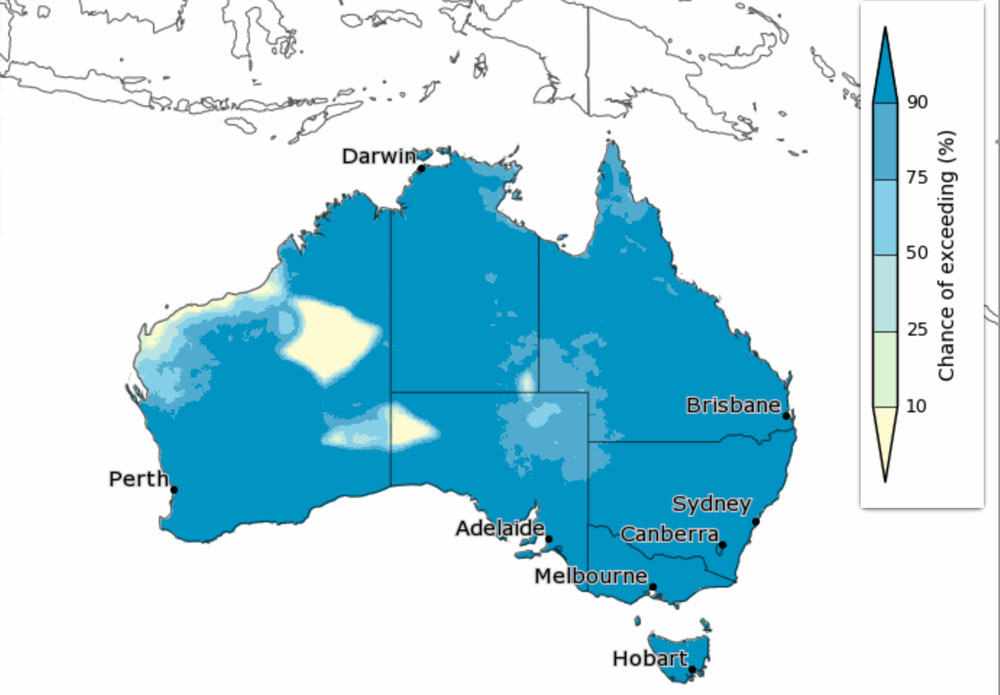
During this outlook period of September to November 2026, it coincides with the northern Australia transition from the dry to the wet season, bringing increased humidity, storms, and showers.
There is an increased chance of unusually high rainfall (50 to 80% chance) across much of northern and central parts of Western Australia.
The dry signal is particularly strong early in the season, extending across much of the country during September, before the wet signal emerges from October as northern Australia begins its transition from the dry to the wet season.
This rainfall forecast is consistent with international guidance, although there is some variation between models in the likelihood of above- and below-average rainfall.
View the video below from The Bureau to gain a better insight as to what weather has prevailed up until now, and what conditions are expected to come further into the season.