With the Pacific Ocean warming rapidly US weather experts advise farmers to take precautionary measures
The financial pressure of paying more for everything, diesel and fertiliser in particular, to get the 2026-27 winter season crop into the ground has been compounded further with US experts officially calling the forming of a severe El Niño event.
The US based National Oceanic and Atmospheric Administration (NOAA) has confirmed an El Niño has now formed in the Pacific Ocean and will most likely develop record-breaking intensity in coming months.
It appears this particular El Niño will peak earlier than usual based on strong early signs over recent weeks and quite often large El Niño events like this one could well last longer than usual.
An ominous footnote to the NOAA’s warning was the 63% chance this El Niño could get so intense over our spring and early summer that it “could rank among the largest El Niño events in the historical record going back to 1950.”
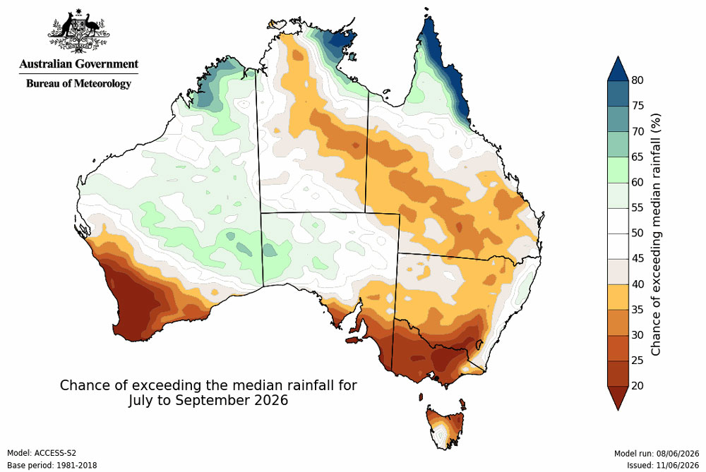
Closer to home the Bureau’s (the Bureau of Meteorology) long-range forecast for July to September holds further concern for caution.
Rainfall begins to fizz out
Expectations of further much appreciated rain across early winter may be severely curtailed if the Bureau’s prediction of below average July to September rainfall is likely across parts of southern and eastern Australia.
In particular, July to September rainfall is likely to be below average (60 to 80% chance) for the South West Land Division of Western Australia, central parts of the Northern Territory, much of southern Queensland, and most of south-east Australia, including Tasmania.
Further, there is an increased chance of unusually low rainfall (40 to 60% chance) across parts of south-west Western Australia and south-east Australia.
And while not much use for winter cereal crops, the Bureau has advised there is an increased chance of above average rainfall across parts of the far north.
This forecast period falls within the northern Australian dry season, when most of the tropical north, except for the east coast of Cape York Peninsula, typically receives very little rainfall. Therefore, only small amounts of rainfall, often less than 20mm, can be enough to exceed seasonal averages.
For most other areas, there is no clear signal for either wetter or drier conditions, meaning there are roughly equal chances of above or below average rainfall.
Overall, this season appears to be positioned in a category of unusually low rainfall, in the driest 20% of July to September seasons from records between 1981 and 2018.
Seasonal outlook prior to El Niño prediction
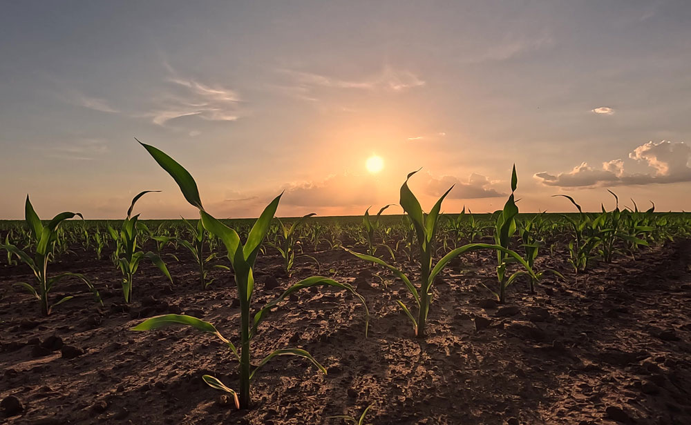
Most growers were delivered a strong confidence boost following the late-May rainfall that accelerated winter crop planting and establishment. An early seasonal break that many expect to see converted into strong harvest yields.
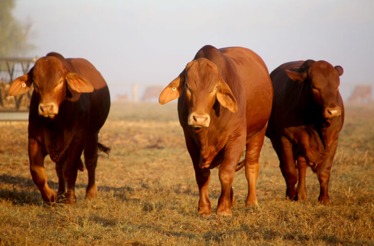
In addition, livestock has contributed strongly to bank balances with most markets trading at elevated levels, supported by tight supply across both sheep meat and wool heading into winter.
In dairy, opening farmgate milk prices held few surprises, with steady incomes ensuring farm margins remain squeezed.
Here is a sector break-down of what farmers are expecting from the 2026-27 season.
• Cattle Improved seasonal conditions abruptly tightened local cattle supply, forcing stronger processor competition and lifting prices.
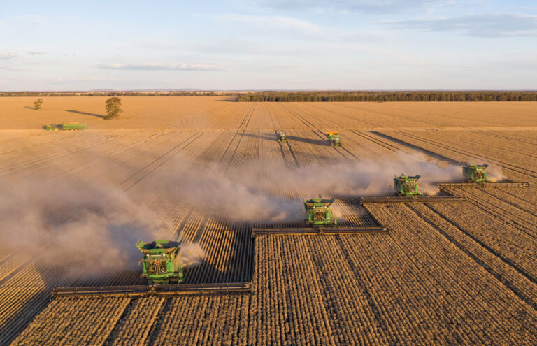
• Cropping Late-May rainfall through southern Queensland and northern NSW reset the season, easing northern wheat and barley prices off their highs. Canola ran against the cereal trend with prices supported by a steady global oilseeds market.
• Dairy Current season farmgate milk prices have set and it shows steady incomes against higher input costs. For most it means margins will remain squeezed in the 2026-27 season.
• Sheep Increasing numbers of lambs from feedlots has resulted in record average carcass weights in the March quarter, with favourable lamb pricing in comparison to grains encouraging growers to put extra weight on stock.
• Wool Despite mid-month dips from buyers prioritising quality, the AWEX EMI rallied late in May as looming supply shortages renewed bidding.
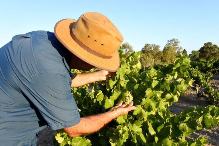
• Horticulture Reduced vegetable plantings are expected to impact supply from August. While the citrus season is nearing its peak, though competition from South Africa may impact export pricing for growers.
Most recent El Niño event
Some farmers may be taking a blasé approach to the current El Niño prediction following the most recent event that developed in spring 2023.
At the time, the worst of that dry spell was felt from August-to-October 2023, and it did have the effect of causing the driest three-month span on record since records began in 1900.
As a result of the dry conditions many bushfires became uncontained by February 2024 with many catastrophic fire danger ratings declared. Fires in the Grampians and western Victoria VIC burning out 28,446ha with 45 homes lost in a single day in the Bellfield area.
Some growers sensed trouble early in the 2023-24 season and as a result plantings were down a million hectares from the previous season to 23 million hectares.
While the winter crop harvest in 2023-24 took the biggest hit from the past 6 seasons with only 47.5 million tonnes making it to the ports. The previous season, 2022-23 there was a record 69.2 million tonnes delivered.
After causing a heightened risk of drought and bushfires, the event concluded when sea surface temperatures in the tropical Pacific cooled substantially and were declared over by the Bureau of Meteorology on 21 April 2024.
See how two winter seasons, 2022-23 and 2023-24, seesawed from a record result to then be hit by an El Niño event and downgraded on this link.
See how early on the current winter season 2026-27 plantings progressed on this link.
Click on the video link below for a direct description about rainfall expectations in your region over the next three months.